Blog
Mapping medieval Swansea
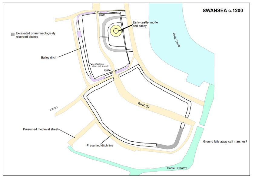
Swansea has undergone many changes in terms of its layout of streets and buildings. The challenge for the project is to recreate the topography of medieval Swansea to aid the understanding of the Cragh text witness statements.
The recreation of the past townscape is being carried out using GIS (Geographical Information System) to manage and analyse archaeological data, historic maps and plans to produce a spatial database and maps. This is a process still in its early stages and builds on the work of previous scholars who have worked on Swansea, and for example this post shows an initial plan for the appearance of Swansea around 1200. This map forms the basis for discussion and will be amended and changed as the project evolves.